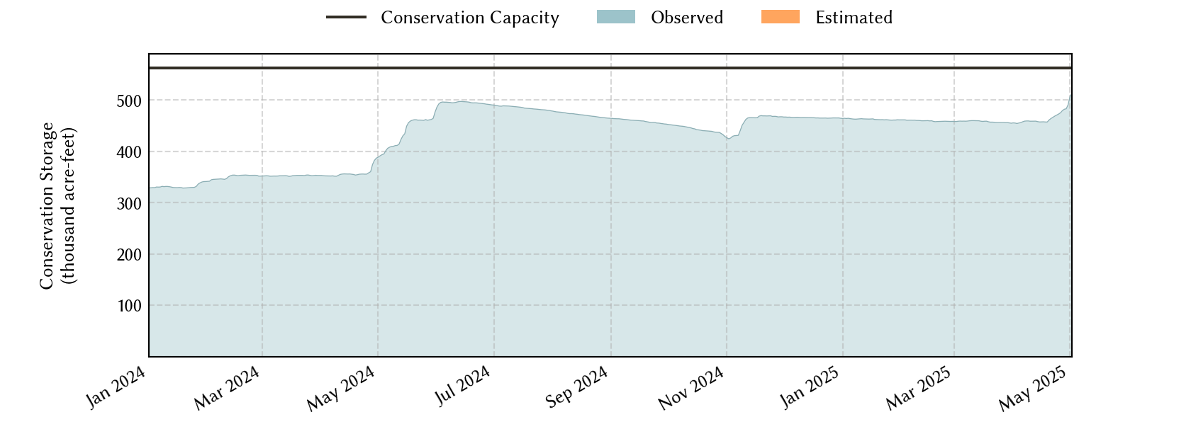
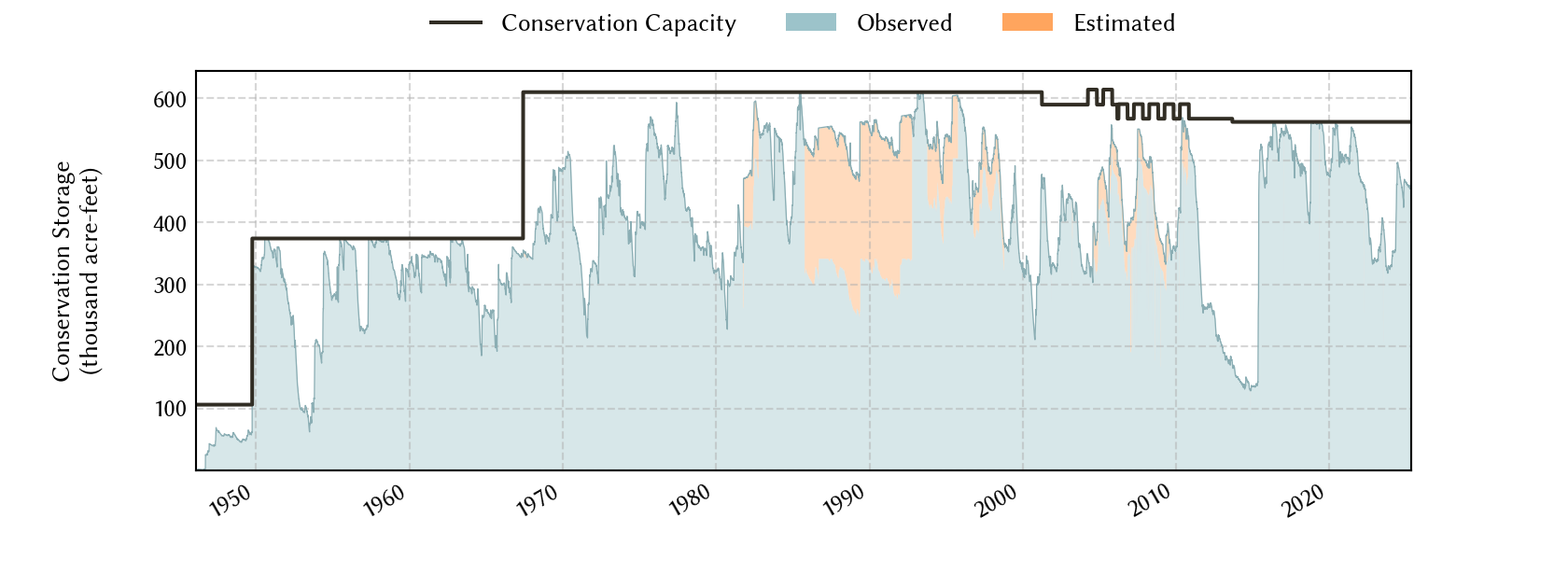
Wichita Falls Area Reservoirs: Monitored Water Supply Reservoirs are 85.5% full on 2026-04-02

Historical Data
| Date | Percent Full |
Reservoir Storage (acre-ft) |
Conservation Storage (acre-ft) |
Conservation Capacity (acre-ft) |
|
|---|---|---|---|---|---|
| Today | 2026-04-02 | 85.5 | 480,432 | 480,306 | 562,011 |
| Yesterday | 2026-04-01 | 85.5 | 480,432 | 480,306 | 562,011 |
| 2 days ago | 2026-03-31 | 85.6 | 481,092 | 480,966 | 562,011 |
| 1 week ago | 2026-03-26 | 87.6 | 492,609 | 492,483 | 562,011 |
| 1 month ago | 2026-03-02 | 89.1 | 501,058 | 500,932 | 562,011 |
| 3 months ago | 2026-01-02 | 90.3 | 507,653 | 507,527 | 562,011 |
| 6 months ago | 2025-10-02 | 94.5 | 538,473 | 531,255 | 562,011 |
| 1 year ago | 2025-04-02 | 80.9 | 458,001 | 454,804 | 562,011 |
*
Percent Full is based on Conservation Storage and Conservation Capacity and doesn't account for storage in flood pool.
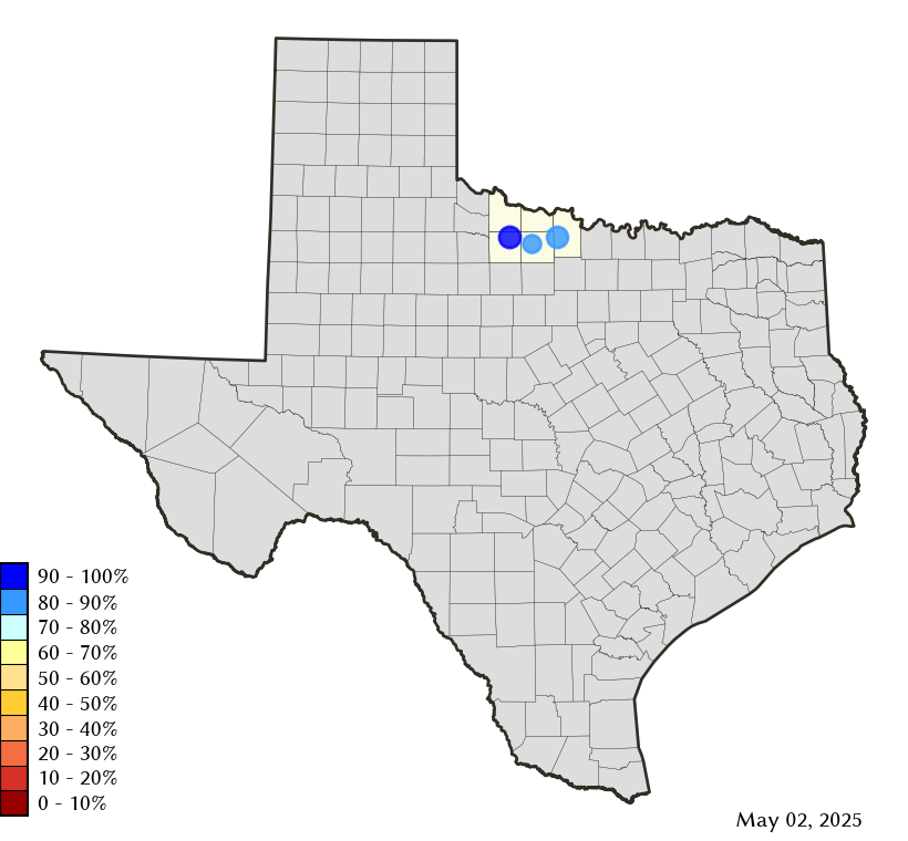
Area Map
Reservoir Storage
| Reservoir | Type | Percent Full |
Water Level (ft) |
Height Above Conservation Pool (ft) |
Reservoir Storage (acre-ft) |
Conservation Storage (acre-ft) |
Conservation Capacity (acre-ft) |
Surface Area (acres) |
|---|---|---|---|---|---|---|---|---|
| Arrowhead |

|
80.5 | 922.71 | -3.29 | 185,426 | 185,426 | 230,359 | 12,809 |
| Kemp |

|
91.1 | 1,142.54 | -1.46 | 223,612 | 223,486 | 245,307 | 14,571 |
| Kickapoo |
|
82.7 | 1,042.31 | -2.69 | 71,394 | 71,394 | 86,345 | 5,252 |