Cypress River Basin Reservoirs: Monitored Water Supply Reservoirs are 94.1% full on 2026-04-01
Historical Data
| Date | Percent Full |
Reservoir Storage (acre-ft) |
Conservation Storage (acre-ft) |
Conservation Capacity (acre-ft) |
|
|---|---|---|---|---|---|
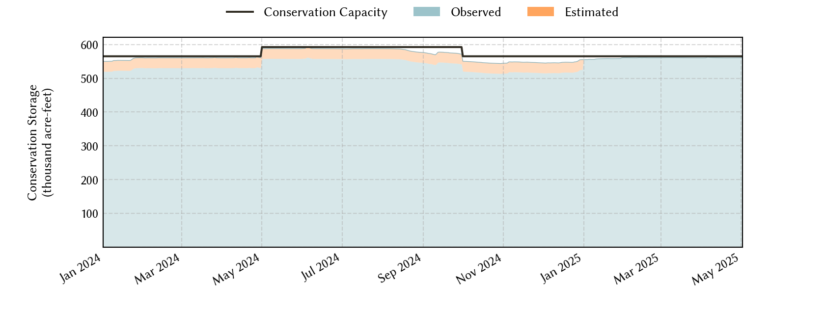
| Today | 2026-04-01 | 94.1 | 651,070 | 531,691 | 565,174 |
| Yesterday | 2026-03-31 | 94.1 | 651,165 | 531,786 | 565,174 |
| 2 days ago | 2026-03-30 | 94.1 | 651,401 | 532,022 | 565,174 |
| 1 week ago | 2026-03-25 | 94.4 | 653,010 | 533,631 | 565,174 |
| 1 month ago | 2026-03-01 | 93.4 | 648,392 | 527,749 | 565,174 |
| 3 months ago | 2026-01-01 | 96.2 | 660,230 | 543,572 | 565,174 |
| 6 months ago | 2025-10-01 | 97.1 | 673,259 | 548,895 | 565,174 |
| 1 year ago | 2025-04-01 | 99.2 | 688,702 | 560,479 | 565,174 |
*
Percent Full is based on Conservation Storage and Conservation Capacity and doesn't account for storage in flood pool.
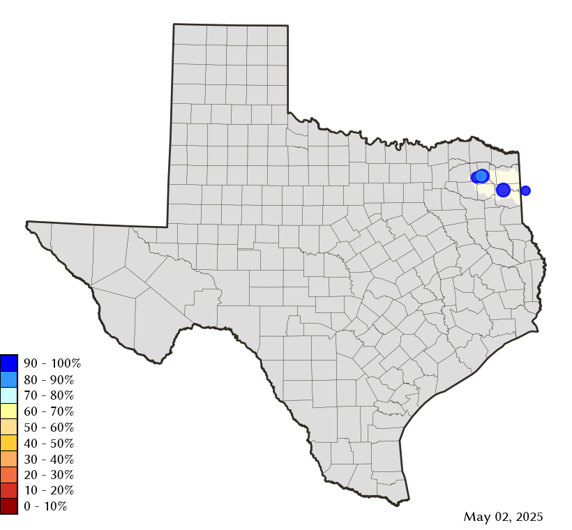
Area Map
Reservoir Storage
| Reservoir | Type | Percent Full |
Water Level (ft) |
Height Above Conservation Pool (ft) |
Reservoir Storage (acre-ft) |
Conservation Storage (acre-ft) |
Conservation Capacity (acre-ft) |
Surface Area (acres) |
|---|---|---|---|---|---|---|---|---|
| Bob Sandlin |

|
93.9 | 336.17 | -1.33 | 191,499 | 180,768 | 192,417 | 8,628 |
| Caddo 1 |
|
100.0 | 168.93 | 0.43 | 138,546 | 29,898 | 29,898 | 27,670 |
| Cypress Springs |
|
96.7 | 377.31 | -0.69 | 64,543 | 64,543 | 66,756 | 3,182 |
| Lake O' the Pines |

|
95.0 | 227.80 | -0.70 | 229,186 | 229,186 | 241,363 | 17,157 |
| Monticello |
|
78.6 | 336.00 | -4.00 | 27,296 | 27,296 | 34,740 | 1,639 |
footnotes
1
Caddo Lake straddles the border of Texas and Louisiana, Texas has rights to 50% of Lake Caddo's total conservation capacity. Percent full, conservation storage and conservation capacity are based on the Texas share.