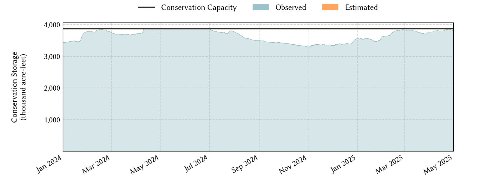
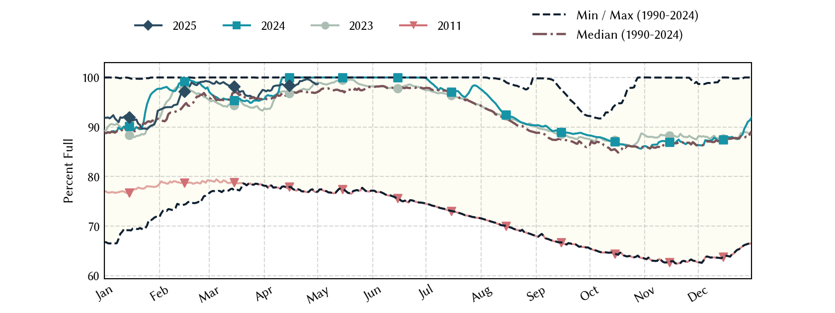
Sabine River Basin Reservoirs: Monitored Water Supply Reservoirs are 89.9% full on 2026-04-01
Historical Data
| Date | Percent Full |
Reservoir Storage (acre-ft) |
Conservation Storage (acre-ft) |
Conservation Capacity (acre-ft) |
|
|---|---|---|---|---|---|
| Today | 2026-04-01 | 89.9 | 5,481,694 | 3,476,363 | 3,868,328 |
| Yesterday | 2026-03-31 | 89.9 | 5,481,895 | 3,476,525 | 3,868,328 |
| 2 days ago | 2026-03-30 | 89.9 | 5,484,495 | 3,478,270 | 3,868,328 |
| 1 week ago | 2026-03-25 | 90.2 | 5,501,848 | 3,489,193 | 3,868,328 |
| 1 month ago | 2026-03-01 | 88.1 | 5,356,445 | 3,406,612 | 3,868,328 |
| 3 months ago | 2026-01-01 | 87.3 | 5,317,203 | 3,378,794 | 3,868,328 |
| 6 months ago | 2025-10-01 | 89.4 | 5,404,713 | 3,458,753 | 3,868,328 |
| 1 year ago | 2025-04-01 | 97.4 | 5,966,738 | 3,766,972 | 3,868,328 |
*
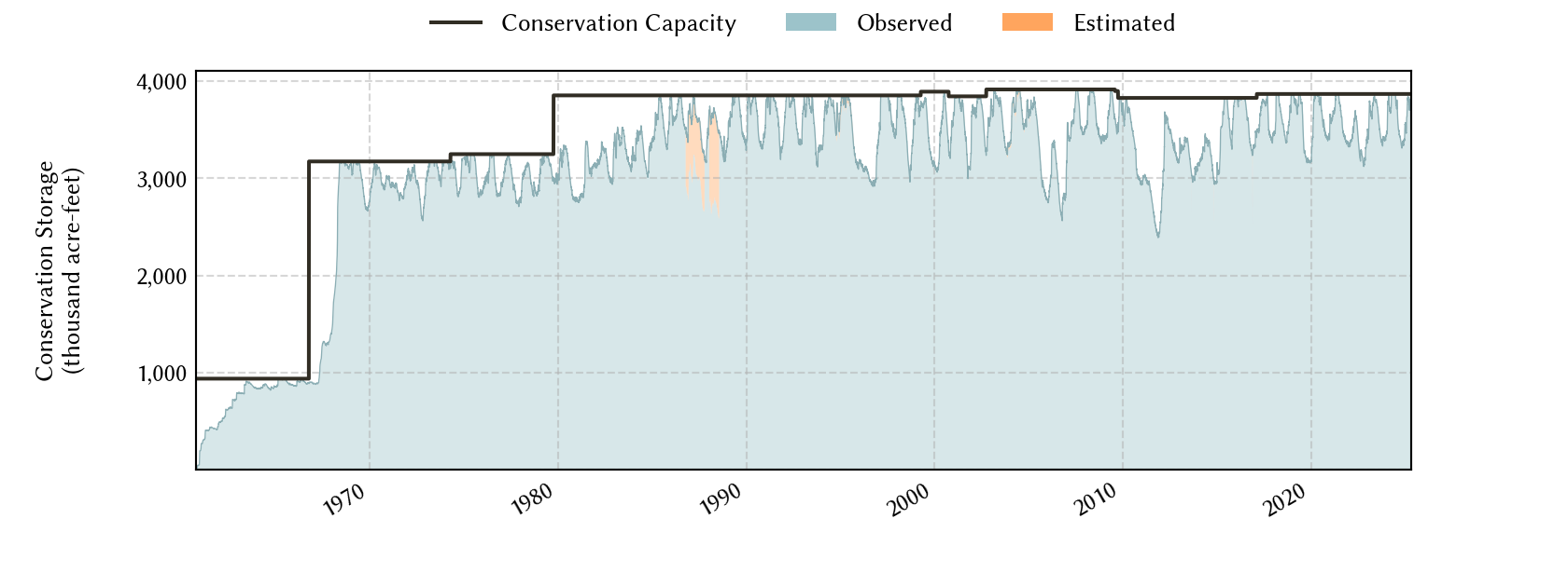
Percent Full is based on Conservation Storage and Conservation Capacity and doesn't account for storage in flood pool.
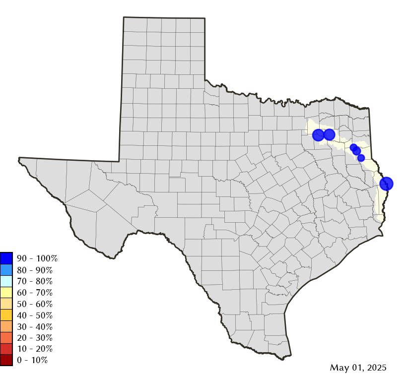
Area Map
Reservoir Storage
| Reservoir | Type | Percent Full |
Water Level (ft) |
Height Above Conservation Pool (ft) |
Reservoir Storage (acre-ft) |
Conservation Storage (acre-ft) |
Conservation Capacity (acre-ft) |
Surface Area (acres) |
|---|---|---|---|---|---|---|---|---|
| Cherokee |

|
100.0 | 280.21 | 0.21 | 45,679 | 40,094 | 40,094 | - n.a. - |
| Fork |
|
87.2 | 399.96 | -3.04 | 559,986 | 528,543 | 606,088 | 24,142 |
| Martin |
|
89.3 | 304.32 | -1.68 | 67,660 | 67,660 | 75,726 | 4,648 |
| Murvaul |
|
99.6 | 265.25 | -0.05 | 38,113 | 38,113 | 38,285 | 3,464 |
| Tawakoni |
|
96.1 | 436.57 | -0.93 | 837,766 | 837,758 | 871,685 | 36,010 |
| Toledo Bend 1 |
|
87.8 | 168.69 | -3.31 | 3,932,490 | 1,964,195 | 2,236,450 | 166,632 |
footnotes
1
Toledo Bend Reservoir straddles the border of Texas and Louisiana, Texas has rights to 50% of Toledo Bend Reservoir's total conservation capacity. Percent full, conservation storage and conservation capacity are based on the Texas share.